


Some roads were already famous before cars existed. Long before GPS or motorways, people crossed continents on foot, by horse, by cart, driven by trade, faith, or war. The routes they carved are still there, running beneath modern asphalt or visible in the landscape itself. If you want a road trip with actual weight to it, these 12 are worth your attention.
Each one follows a path that people traveled for reasons that mattered. You’ll drive through the same mountain passes, the same port cities, the same pilgrimage towns. The history doesn’t make the scenery any less beautiful. It just gives it something to say.


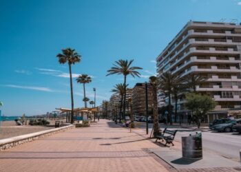
1. Camino de Santiago, Spain
Saint-Jean-Pied-de-Port to Santiago de Compostela
The Camino has been walked for over a thousand years, but driving it reveals a different kind of relationship with the route. You get context. You see how the terrain shifts from the Pyrenean foothills of Navarre into the flat Meseta of Castile, then rises again into the green hills of Galicia. The French Way is the most established corridor, stretching roughly 800 kilometers across northern Spain.
Saint-Jean-Pied-de-Port is a small Basque town just over the French border and the traditional starting point of the Camino for centuries. The narrow streets, the pilgrim office, the stone archway at the edge of town. Even driving through, you feel the weight of departure. The first pass over the Pyrenees into Roncesvalles is one of the most scenic stretches of the whole route.
The Plaza del Obradoiro is the kind of square that earns its reputation. The cathedral facade is enormous and ornate, and arriving there after following the route feels genuinely earned. The old city is compact and walkable.
2. Route Napoléon, France
Golfe-Juan to Grenoble
In March 1815, Napoleon landed at Golfe-Juan on the French Riviera with around a thousand soldiers and marched north toward Paris, bypassing royalist towns by cutting through the Alps. The route he took became Route Napoléon, now the D1085 and N85, a 325-kilometer drive that climbs from the coast into serious mountain terrain.
Grasse is the first notable stop, known for its perfume industry and its hilltop position above the coast. From there, the road passes through Castellane, perched beneath a dramatic limestone cliff, and Digne-les-Bains, a town famous for lavender and its geological park. The landscape gets wilder the further north you go. This is one of the few drives in southern France where you feel genuinely remote.
Grenoble sits in a wide alpine valley surrounded by three mountain ranges. Coming into it from the south on Route Napoléon gives you a long, open approach — the city appears below you as the road descends. Napoleon reached Grenoble to cheering crowds. The city’s museum and old fortifications are worth a half-day, and from here, he continued to Paris without firing a single shot.
3. The Romantic Road, Germany
Würzburg to Füssen
The Romantische Strasse links medieval market towns, baroque churches, and vineyard-covered hills across roughly 460 kilometers of southern Germany. It follows trade corridors that were active throughout the Middle Ages. The name came later, coined in the 1950s to promote tourism, but the towns themselves predate that branding by centuries.
Füssen sits at the southern end of the route, close to the Austrian border. Neuschwanstein Castle sits above the town and is the most-photographed castle in Germany, the 19th-century fantasy architecture against an alpine backdrop is extraordinary. The route ends here, but you’re well positioned to continue south into Austria or east toward Munich.
4. Via Appia, Italy
Rome to Brindisi
The Appian Way was begun in 312 BC and is one of the most <a href=”https://adventure-chest.com/ancient-roman-roads/”>ancient Roman roads </a>. It connected Rome to the port at Brindisi, the main gateway to Greece and the eastern Mediterranean. At its peak, the road stretched nearly 600 kilometers and was lined with tombs, milestones, and temples for its entire length. Large sections of the original stone surface still exist.
The best-preserved section of the original road starts just outside Rome’s Aurelian Walls and runs southeast through the Appia Antica Regional Park. You can drive it, but walking or cycling the oldest section is genuinely memorable. Large basalt stones, worn smooth over centuries, flank the road with ancient tombs and scattered ruins. The Catacombs of San Callisto and the Villa of Maxentius are both here.
5. Via Egnatia, Balkans
Durrës to Thessaloniki to Istanbul
The Via Egnatia was built by the Romans in the 2nd century BC to link the Adriatic coast with Constantinople. It ran roughly 1,120 kilometers through what is now Albania, North Macedonia, Greece, and Turkey, functioning for nearly two thousand years as the main overland artery between Rome and its eastern empire. Julius Caesar’s army marched it. So did the Crusaders, centuries later.
Durrës is Albania’s main port city and the western starting point of the <a href=”https://adventure-chest.com/via-egnatia/”>Via Egnatia</a>. The Roman amphitheater here is one of the largest in the Balkans and sits in the middle of the modern city, which gives it a surreal quality. Albania is still undervisited relative to its Balkan neighbors, and road conditions vary on smaller connecting roads. Build extra time into your days here.
The original terminus of the Via Egnatia was the Golden Gate, the ceremonial entrance into Constantinople on the western edge of the city. The gate still stands, incorporated into the Yedikule Fortress. Entering Istanbul from the west by road, following the ancient route, gives you a completely different sense of the city than arriving by air. You see the land walls, the scale of the old city, and the geography that made it unconquerable for so long.
6. Hanseatic Trade Route
Lübeck to Riga to Tallinn
The Hanseatic League was a commercial alliance of northern European port cities that dominated Baltic trade from the 13th to the 17th centuries. At its height, it connected over 200 cities. The core route linking Lübeck, Riga, and Tallinn follows the same logic it always did — a chain of fortified merchant cities spaced along the Baltic coast and its approaches.
Lübeck was the founding city of the Hanseatic League and its unofficial capital for centuries. The Holstentor, a double-towered brick gate from 1478, is the city’s most iconic structure and one of the finest examples of late Gothic brick architecture in northern Europe. The entire old town is a UNESCO site. Lübeck is also the birthplace of marzipan and Thomas Mann, and it takes those facts with equal pride.
Riga joined the League in the 13th century and became its major outpost in the eastern Baltic. The old town contains well-preserved medieval warehouses, guild buildings, and churches that reflect this history directly. Riga also has one of the finest collections of Art Nouveau architecture in the world, concentrated in a district just north of the old city, an unexpected bonus for a place people come to for medieval history.
Tallinn’s medieval core is the best-preserved in the entire Baltic region. The city walls, watchtowers, and merchant houses are largely intact and give the old town a quality that’s genuinely rare in northern Europe. During the Hanseatic period, Tallinn was called Reval and served as the League’s main link to Scandinavian trade. The upper town, Toompea, has views across the rooftops that immediately explain why merchants fought to control this position.
7. Amber Road, Central Europe
Baltic Sea to Northern Italy
Amber was among the most valuable commodities in prehistoric and early European trade. Long before the Romans arrived, routes carrying Baltic amber south to the Mediterranean were already established. The main corridor ran from the amber-rich coast of what is now Poland south through Moravia, Austria, and the Alps to the Roman city of Aquileia in northern Italy. It was used for at least two thousand years.
The Amber Road’s northern end sits along the Polish and Lithuanian Baltic coast. Gdansk is the most logical starting point as it has a dedicated amber museum and a beautiful medieval old city that was meticulously rebuilt after World War II.
The route heads south through Poland toward Kraków, one of Europe’s most complete medieval cities, its old center surviving the war largely intact. From Kraków, it continues into the Czech Republic and Austria, with Vienna marking a major waypoint. Each city along this corridor shows evidence of long pre-Roman settlement, largely because the Amber Road brought enough wealth to make permanent habitation worth the investment.
8. Silk Road European Gateway, Turkey
Istanbul to Cappadocia
The Silk Road’s western end terminated at Constantinople, where goods from China, Central Asia, and Persia entered Europe. The road east from Istanbul through Anatolia was the gateway into that entire network. The drive covers roughly 750 kilometers and follows the corridor that caravans used for centuries to move silk, spice, and dye across the continent.
The Grand Bazaar and the Spice Market are the most visible remnants of Istanbul’s role as a trade hub. But the hans, Ottoman-era caravanserais built to house merchants and their goods, are scattered throughout the old city and are more historically specific.
Cappadocia has been continuously inhabited since at least the Bronze Age, partly because its soft volcanic rock made it easy to carve out shelter and storage. Caravans traveling the Silk Road stopped here regularly. The underground cities of Derinkuyu and Kaymakli, carved deep into the rock, were large enough to hold thousands of people and their animals. The cave hotels here are genuinely good, and many are built into the same rock formations used for millennia.
9. Alpine Trade Route, Switzerland to Italy
Lucerne to St. Gotthard Pass to Milan
The St. Gotthard Pass has been a key crossing point through the Alps since at least the 13th century, when a bridge over the Schöllenen Gorge first made it viable for pack animals. Before roads and tunnels, crossing here required significant preparation and considerable luck. The modern road follows the same alignment, climbing to 2,106 meters above sea level before descending into Ticino and then northern Italy.
Lucerne is one of Switzerland’s most photogenic cities and a logical starting point for the southern crossing. The Chapel Bridge, a 14th-century wooden covered bridge, is the city’s signature landmark. Lake Lucerne extends south toward the mountains, and the approach to the Alps begins almost immediately once you leave town. It’s worth spending a full day here before the drive south.
The pass road is open roughly from May to October, depending on snowfall. The old Tremola road, a cobblestone route with 24 hairpin bends, runs parallel to the modern road and is worth taking if conditions allow. It’s slower and rougher, but the surface is the same stone that medieval merchants, soldiers, and pilgrims crossed. The hospice at the summit has been offering shelter since the 13th century.
10. Wild Atlantic Way, Ireland
Donegal to Cork
Ireland’s western coast has been a place of trade, migration, and seafaring for thousands of years. The Wild Atlantic Way, a marked route along the entire Atlantic coastline, covers roughly 2,500 kilometers. It follows the older logic of coastal movement, all the way from Donegal in the northwest down to Cork in the south, is one of the longest defined coastal routes in the world.
Donegal is the northwesternmost county in the Republic of Ireland and one of the most sparsely populated. The Slieve League cliffs here reach 601 meters, making them among the highest sea cliffs in Europe, and they draw far fewer visitors than the more famous Cliffs of Moher further south. The coastal roads in Donegal are narrow and winding, which slows you down in a useful way. This is not a route you drive fast.
The route’s southern stretch through County Kerry includes the Ring of Kerry and the Dingle Peninsula, both well-established circuits worth building extra time into. Cork itself is Ireland’s second city, with a strong food culture and a compact old center built on islands in the River Lee.
11. North Coast 500, Scotland
Inverness loop
The NC500 is an 830-kilometer loop starting and ending in Inverness, running along Scotland’s northern and western coasts. It was formally launched in 2015 but follows coastal roads that have existed for centuries, serving isolated communities and historic castles that predate the route’s branding by hundreds of years. Most people allow five to seven days to do it properly.
Inverness is the largest city in the Scottish Highlands and the practical base for supplies and preparation before the loop. Loch Ness is immediately south of the city, and Inverness Castle sits above the River Ness in the center.
Durness is about as far northwest as you can get on the British mainland. The village sits above a series of sandy beaches that look implausibly tropical in good weather. Smoo Cave, a sea cave accessible from Durness, has been used as a shelter since the Neolithic period. The drive along the north coast between Durness and Thurso is exposed, open, and unlike anything else in Britain.
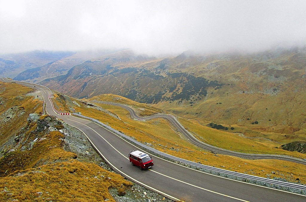
12. Transfăgărășan Corridor, Romania
Curtea de Argeș to Sibiu
The Transfăgărășan was built between 1970 and 1974 on the orders of Nicolae Ceaușescu, intended as a military access route over the Fagaras Mountains following the Soviet invasion of Czechoslovakia in 1968. It runs 90 kilometers across the highest range in Romania, reaching 2,042 meters at its peak. The mountain passage it follows, however, is far older: Dacian and Roman armies crossed this range long before asphalt existed.
The Fagaras Mountains served as a natural barrier between Wallachia to the south and Transylvania to the north for most of Romanian history. Curtea de Argeș, the starting point, was the first capital of Wallachia and contains one of Romania’s most celebrated monasteries, built in the 16th century. The Communist-era road is relatively recent; the logic of crossing here is not.
The road rises sharply through forested valleys before breaking out above the treeline. The Vidraru Dam and its reservoir appear along the way, a large piece of 1960s engineering that creates a striking contrast with the natural landscape above it.
These twelve routes cover roughly 4,000 years of European movement. The motivations were different each time: faith, commerce, empire, survival. But the geography was always the same. Mountains that had to be crossed, coasts that had to be followed, cities that had to be connected.