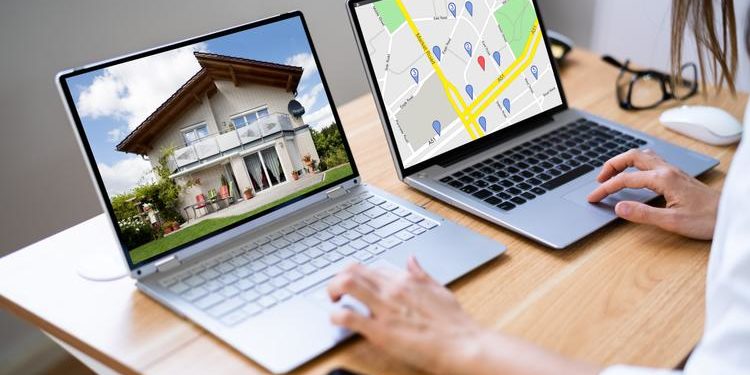
Organising and evaluating map data could seem impossible without an appropriate web tool platform. However, with the necessary technology, such as GIS software, you can study maps easily and effectively.
Introduction to GIS
A Geographic Information System is a software tool that analyzes, stores, manipulates, and visualizes geographic information.
While mapping is fundamental, GIS does much more. GIS is a data creation, management, analysis, and mapping technology.
GIS links data to a map by combining location data—which shows where things are—with various forms of descriptive information—which describes what things are like there.
Every day, GIS and spatial thinking enable innumerable decisions across various industries. These “geographic” issues necessitate spatial reasoning and spatial analysis because everything occurs in a specific location. GIS can help with that. If you know a few tricks, it can do all the work for you. “Work smarter, not harder” is the motto!
With the help of GIS, you can link attribute data—Excel’s version of columns—with their geographic position, including coordinates, longitude, and latitude. This lets you visualise your spatial data on a map and bring disparate information to life. When you analyze georeferenced data, processing presented information and extracting the information pertinent to your workflow is simpler. This covers everything, from gathering and examining field data to tracking project developments from the office and producing maps instantly.
Applications of GIS Mapping Services
GIS mapping services are indispensable across various industries, transforming complex challenges into actionable solutions. Below are some applications of GIS:
- Urban Planning
GIS mapping helps urban planners visualize land use, assess population density, and optimize infrastructure layouts. For instance, zoning and transportation networks can be strategically designed by analyzing spatial data.
- Environmental Conservation
By tracking habitat changes and analyzing deforestation patterns, GIS mapping aids in preserving ecosystems. Conservationists use these maps to identify areas requiring urgent protection or rehabilitation.
- Real Estate
Real estate professionals leverage GIS mapping to evaluate property values, understand demographic trends, and perform site selection. For example, GIS tools can analyze proximity to amenities, transportation, and utilities, making it easier to identify ideal investment opportunities.
- Disaster Management
GIS mapping is critical in disaster response and risk assessment. Emergency planners use it to map flood-prone areas or forecast the impact of natural disasters, ensuring quicker, more efficient mitigation efforts.
- Infrastructure Development
Whether it’s laying out road networks, planning pipelines, or designing utility systems, GIS mapping provides the spatial insights needed for accurate infrastructure planning and execution.
Benefits of GIS
Enhanced Decision Making
GIS Navigator’s most significant advantage is its ability to visualise and analyse complex spatial data. By combining data from multiple sources onto a single map, decision-makers can obtain critical insights into links, patterns, and trends that would otherwise go unnoticed. GIS solutions can help you find possibilities, make well-informed decisions, and deal with problems more quickly.
Improved Planning and Resource Management
GIS can improve workflow efficiency and resource allocation. For example, environmental agencies can monitor natural resources and wildlife habitats, while urban planners can use it to construct effective transit networks and identify neglected areas. You may formulate intelligent plans for resource management and sustainable growth with GIS.
Effective Customer Engagement
Using GIS solutions in consumer engagement tactics has the potential to revolutionise the industry. By leveraging location-based data, businesses can better understand customer behaviour, preferences, and needs. Thus, more focused advertising efforts, customised deals, and enhanced client experiences are possible. With the help of location information driven by GIS Navigator, businesses can send the appropriate message to the right audience at the right time.
Precise Market Analysis
GIS provides powerful market analysis tools for companies looking to grow or establish new branches. GIS techniques can overlay competitor locations, demographic data, and customer behaviour patterns to find unexplored markets and possible growth areas. Comprehending the geographical context aids businesses in formulating strategic choices and mitigating expansion-related risks.
Efficient Asset Management
GIS is essential for effectively managing physical assets. It efficiently tracks, monitors, and maintains assets to manage utility infrastructure, transportation networks, or public amenities. By integrating real-time data with GIS, organisations may extend the life cycle of essential infrastructure, minimise downtime, and enhance asset performance.
Disaster Preparedness and Response
GIS has proved essential in disaster response and preparation situations. Emergency services can use GIS to plan evacuation routes, assess impacted areas, and organise relief efforts. By visualising real-time data, responders can prioritise resources where they are most required, saving lives and reducing damage.
Enhanced Collaboration and Communication
GIS encourages cooperation and communication among many departments and teams. Centralising data on a common platform allows all parties to access the most recent information, minimising effort duplication and misunderstandings. GIS makes it easier to solve problems cohesively and creates an atmosphere conducive to creativity.
Enhance Business Operations and Marketing
GIS is not just for government and non-profit organisations. Businesses of all sizes can also benefit from the power of geospatial data and analysis.
GIS can help businesses make informed decisions about their operations and marketing strategies by providing a platform for storing and analysing customer data.
A retail business can use GIS to analyse its customers’ demographics and identify the best locations for new stores.
Leveraging geospatial data to understand customers’ needs and preferences enables businesses to make informed decisions about their operations, enhancing their competitiveness and overall performance.
Improve Environmental Management
GIS in environmental management has proven invaluable. It gives us a platform to store, process, and display ecological data, which enables us to understand better how human activity affects the ecosystem and to make decisions that will lessen that impact.
GIS can analyse the distribution and amount of deforestation, a significant cause of climate change. By tracking changes in forest cover over time, GIS can assist us in identifying areas in danger of deforestation and preventing it.
How is GIS used?
GIS enables diverse perspectives on the world by mapping the number and location of objects, the density of people and objects, and any changes occurring. Additionally, it enables us to detect events within or close to a certain location.
More specifically, GIS is used through:
- Environmental Geography: to analyse the impact people have on the environment.
- Physical Geography: to study the elements of the atmosphere, biosphere, and geosphere.
- Emergency Management Information System: to give real-time data about the geographical layout to emergency responders.
- Health Geography: to use geographical information to study health-related issues such as disease and illness.
- Economic Geography: to study economic activities across the earth.
- Transportation Geography: to investigate the spatial interactions of people or things.
Conclusion
Lastly, GIS is a powerful tool that has completely changed how we see and understand the world. It enables us to manage, arrange, and assess geographic data to make informed decisions.
GIS has become indispensable because of its ability to understand and interpret geographic data, optimise planning and decision-making, enhance environmental management, enhance emergency response and disaster management, and improve corporate operations and marketing.
Therefore, organisations of all kinds, including government, non-profit organisations, and small and medium-sized corporations, benefit from using GIS to extract insights from geographic data. Furthermore, because Geoapify is the industry leader in geospatial analytics, there are many chances for innovation and progress!
Contact GIS Navigator for more information or projects.

![7 Best POS Software in the UK [2026 Edition]](https://todaynews.co.uk/wp-content/uploads/2026/02/7-Best-POS-Software-in-the-UK-2026-Edition-360x180.png)


![7 Best POS Software in the UK [2026 Edition]](https://todaynews.co.uk/wp-content/uploads/2026/02/7-Best-POS-Software-in-the-UK-2026-Edition-120x86.png)


