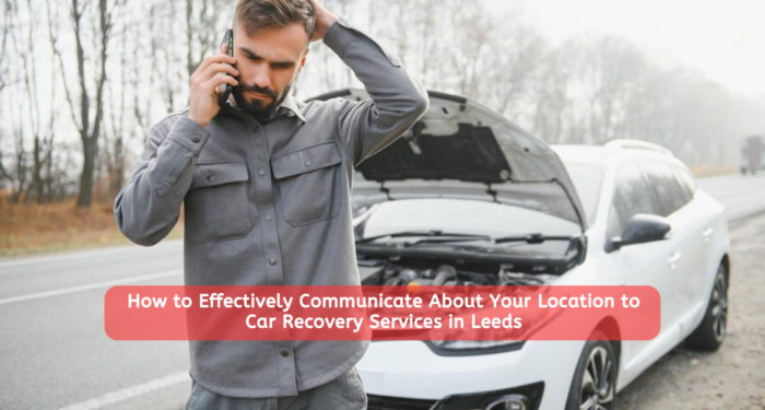
In moments of car trouble, effective communication with car recovery services can make a significant difference in the speed and efficiency of the assistance you receive.
This todaynews’s article explores how to communicate your location accurately to car recovery services in Leeds, ensuring that help arrives promptly and efficiently.
Understanding the nuances of location communication, including local landmarks, road types, and technology tools, can save time and reduce stress during these critical moments.
Geographical Information
Understanding Leeds’ Geography
Leeds, located in West Yorkshire, England, is a bustling city with a mix of urban and rural landscapes. Its geography includes city centers, suburban neighborhoods, and rural outskirts, each presenting unique challenges for car recovery services.
Key Areas in Leeds
- City Centre:
Known for its busy streets, numerous landmarks such as Leeds Town Hall, shopping districts, and dense traffic, making it vital to give precise location details. - Suburbs:
Residential areas such as Headingley and Chapel Allerton are characterized by quieter streets, local shops, schools, and parks. Providing house numbers or nearby intersections is essential. - Rural Outskirts:
Areas like Otley and Ilkley Moor feature country roads, farmlands, and less prominent signposts, requiring detailed descriptions or GPS coordinates for accuracy.
Road Types and Significance
- Major Roads:
The A58, A61, A64, and the M1 motorway are critical routes connecting various parts of Leeds. These roads are well-marked and heavily trafficked, so noting nearby exits or mile markers is helpful. - Minor Roads:
These include smaller streets and alleys often found in suburban and residential areas, requiring specific street names and nearby landmarks for easy navigation. - Rural Roads:
Narrow lanes and countryside paths, common in the outskirts, are less straightforward and may not appear on all maps, necessitating clear descriptions of nearby features or GPS use.
Local Car Recovery Service Recommendation
Choosing a local and experienced Vehicle recovery service can significantly improve the efficiency and effectiveness of assistance during breakdowns in Leeds.
Local services are familiar with the area’s roads, traffic patterns, and potential challenges, allowing them to navigate swiftly to your location. Additionally, their knowledge of the local terrain and landmarks enables them to provide quicker and more accurate assistance.
Consider opting for a reputable local car recovery service in Leeds to ensure prompt and reliable help when you need it most.
Preparing for Communication
Gathering Essential Information
Before contacting car recovery services, gather the following:
- Exact Location:
Use GPS or identify landmarks to provide a precise location. This can include street names, nearby buildings, or natural features. - Vehicle Details:
Be ready to provide the make, model, color, and any visible damage or issues with your vehicle to ensure the recovery team arrives prepared. - Personal Safety:
Ensure you’re in a safe spot away from traffic. If possible, move your vehicle to the side of the road or a designated safe area.
Using GPS and Map Applications
- Google Maps:
Pin your location and share the pin with the service for precise coordinates. This can be done via text message or directly through the app. - Apple Maps:
Offers similar functionality to Google Maps, allowing you to share your exact location with car recovery services quickly. - Waze:
Provides real-time traffic updates and the ability to share your live location, which is particularly useful if you’re on a busy road.
Importance of Clear Communication
Clear and concise communication reduces misunderstandings and speeds up the recovery process. Avoid jargon and stick to straightforward descriptions, ensuring the person on the other end understands your exact situation and location.
Effective Location Communication
Describing Your Location
- Urban Areas:
Use specific street names, nearby businesses, or prominent buildings to describe your location. Mentioning cross streets or nearby intersections can also be very helpful. - Suburban Areas:
Provide residential street names, house numbers, and nearby parks or schools. Describing distinctive features of your surroundings, like unique house colors or structures, can be beneficial. - Rural Areas:
Refer to farm names, mile markers, or natural landmarks such as rivers or hills. Detailed descriptions of your surroundings are crucial in these areas where traditional street signs may be sparse.
Using Landmarks
Identify well-known landmarks such as:
- Leeds General Infirmary:
A central reference point that is widely recognized. - Roundhay Park:
A large and well-known park in Leeds, useful as a reference point for nearby locations. - University of Leeds:
A major institution with clear boundaries, which can be helpful for pinpointing your location if you’re nearby.
Coordinates and Map Links
Sharing GPS coordinates or a map link provides precise location data:
- Coordinates:
Easily obtained from map applications, providing exact latitude and longitude. - Map Links:
Send a link to your exact position on Google Maps or similar services, allowing the recovery team to see your location on their device.
Handling Common Scenarios
Breakdowns on Motorways
- Safety First:
Move to the hard shoulder or a safe area, turn on your hazard lights, and exit the vehicle if safe to do so. - Precise Location:
Use mile markers, nearest exit information, or emergency phones to provide an exact location to the recovery service.
Breakdowns in Urban Areas
- Street Details:
Provide specific street names, house numbers, and intersecting roads to help the recovery service locate you quickly. - Landmarks:
Mention nearby shops, cafes, or notable buildings that can serve as additional reference points.
Breakdowns in Rural Areas
- Natural Landmarks:
Identify and describe hills, rivers, or notable trees that can serve as markers. - Local Knowledge:
Use farm names, nearby villages, or local points of interest to provide more context about your location.
Technology Tools for Location Sharing
GPS Devices
Standalone GPS devices provide accurate location data, especially useful in areas with poor mobile signal. They can offer precise coordinates that you can relay to the recovery service.
Smartphone Applications
- WhatsApp:
Share your live location for a set period, allowing the recovery team to track your movements if you’re in a moving vehicle or need to relocate for safety. - Google Maps:
Send your location pin through various communication methods, ensuring the recovery service has your exact coordinates. - Waze:
Provides real-time traffic updates and location sharing, beneficial for recovery services navigating through traffic.
In-Car Navigation Systems
Many modern vehicles come equipped with navigation systems that can directly share location data with recovery services, offering a seamless way to communicate your exact position.
Communication Tips
Staying Calm and Clear
Maintain composure to ensure you provide clear and accurate information. Panic can lead to errors in communication, so take deep breaths and speak slowly.
Practicing Descriptions
Regularly practice describing your location to ensure you can do so under stress. This can involve explaining your route to a friend or family member as a drill.
Using Technology Efficiently
Familiarize yourself with location-sharing features on your devices to use them effectively in emergencies. Ensure your phone is always charged and keep a car charger handy.
Personal Stories or Case Studies
Case Study: Urban Breakdown
John’s car broke down in Leeds city center. By using Google Maps to send his exact location and mentioning nearby landmarks, a local recovery service reached him swiftly, demonstrating the importance of combining technology with clear communication.
Case Study: Rural Breakdown
Emily’s car stalled near Otley. She used her smartphone to share her coordinates and described her proximity to a well-known farm, ensuring a quick recovery despite the rural setting. Her preparedness and use of precise location tools proved essential.
Expert Insights
Professional Advice
Experts recommend having a backup power source for your phone and regularly updating your map applications to the latest versions to ensure accuracy and functionality during emergencies.
Quotes from Recovery Professionals
“Accurate location sharing can cut our response time by half,” says Mark Thompson, a senior vehicle recovery service manager in Leeds.
- “The more precise the information we receive, the quicker we can provide assistance.”
Conclusion
Effectively communicating your location to car recovery services in Leeds involves understanding local geography, using technology tools, and providing clear and concise information.
By preparing in advance and staying calm during an emergency, you can ensure that help arrives promptly, reducing stress and downtime.


