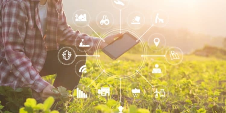
Precision farming allows farmers to optimize the use of all resources, from time to fertilizers. It is based on satellite images, so growers can remotely control the entire production process. They receive data on field conditions, crops, weather changes, etc. At the same time, satellite technologies constantly improve, providing more transparent images and detailed information. Here are five benefits of satellite imagery for agribusiness.
Vegetation Indices: A Key Tool In Crop Monitoring
Vegetation indices reflect vegetation parameters in image pixels. They are calculated based on operations with spectral ranges of remote sensing data. The plant’s reflectivity directly affects the performance of indicators. For objectivity, two or more stable spectral bands are used for analysis. The active use of vegetation indices began in 1974. Observing photo-centric activity and monitoring changes in vegetation can accurately assess crop health, yield growth, and other parameters.
Based on the data obtained, AI creates vegetation maps that give an idea of the vegetation throughout the entire growth period. Thus, using multispectral sensors, the NDRE vegetation map displays the strength of crop growth during the cycle. The abbreviation NDRE stands for normalized Difference Red Edge. This “red edge” technology allows farmers to penetrate deeper into the foliage and better analyze changes than the more common NDVI (normalized difference vegetation index). Therefore, NDRE is excellent for monitoring chlorophyll and nitrogen concentration.
Accuracy Of Data For Making Decisions
This aspect is crucial for the development of a farmer’s production strategy. Satellite monitoring combines satellite imagery with AI-powered machine learning that allows you to define field boundaries and crop types. However, this technology evolves, opening up new possibilities. For example, developers work on algorithms to create fertilizer manuals. What’s more, satellite technologies enable farmers to monitor changes in weather and temperature and reveal regional averages. It allows growers to produce high-quality yield forecasts and identify problems on time to take effective solutions to eliminate them. Thus, satellite technologies can significantly improve the agricultural process.
Crop Diseases Identification
Diseases can cause the death of the entire crop. Therefore, it is vital to identify the threat at an early stage. Remote zoning technology makes it possible to detect dangerous signs over a large area at a minimal cost. Farmers can determine entire infested areas using satellite imagery and spatial analysis techniques.
EOS Crop Monitoring uses vegetation indices such as NDVI, NDMI, and NDRE to identify problem areas. Moreover, using the scouting function, the platform can monitor the presence of the pathogen to prevent the disease. If a problem is found, scouts can compile a report with a classification of the type of disease — abiotic or biotic. Photos may accompany the information to demonstrate the problem better. Using EOS Crop Monitoring saves a lot of time and fuel for machinery and promotes the rational use of chemicals for disease or pest control. Additionally, farmers can use the zoning function to map the vegetation. It can display the dynamics of the disease spread, which allows farmers to plan their actions better.
Reduced Insurance Cost
For insurers, agricultural coverage is risky. The thing is that it is difficult for them to obtain objective information about farms and monitor the activities of farmers. It leads to high rates, which are highly disadvantageous for agricultural producers. This situation hindered this type of service for a long time, especially in developing countries.
Satellite technology increases insurance transparency, allowing each participant to thoroughly analyze the crop state and the risks to the environment. For example, insurers can develop policies based on vegetation indices and use satellite data to create a system for assessing the creditworthiness of agricultural producers. Farmers can profitably insure their production, significantly reducing financial risks. They also receive tools to collect evidence in case of damage. It reduces the chance of non-payment under the insurance policy.
Thus, satellite monitoring provides many benefits to farmers. The main one is timely solutions. By making yield forecasts and analyzing the state of vegetation throughout the agricultural cycle, farmers can adjust each direction of the production process.
The use of satellite technology helps to attract capital to the industry. Investors can analyze the profitability of a particular farm and predict the potential return on their investment. Insurers can use satellite data for risk assessment and policy development.
Satellite monitoring is also helpful for traders and manufacturers of agricultural machinery. The former can analyze the factors affecting the yield of certain crops in the region to predict the market trend. The latter can upgrade their products based on the data received.
In addition to the listed economic and production benefits, satellite monitoring contributes to the development of sustainable agriculture. It minimizes environmental damage by reducing the use of natural resources or hazardous substances and prolonging the soil’s health.
David Prior
David Prior is the editor of Today News, responsible for the overall editorial strategy. He is an NCTJ-qualified journalist with over 20 years’ experience, and is also editor of the award-winning hyperlocal news title Altrincham Today. His LinkedIn profile is here.


